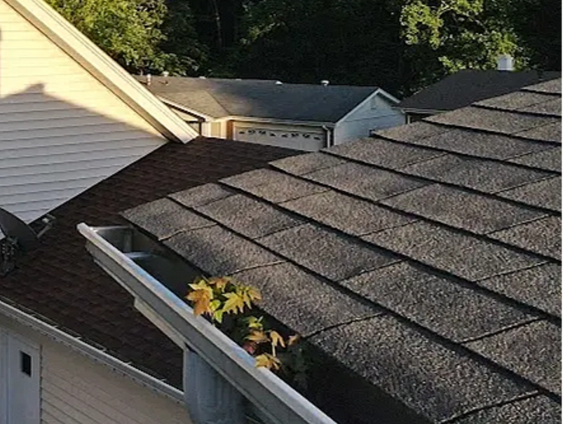
~ Roof and Gutter Inspections with Drone Technology ~
State-of-the-art Roof and Gutter Inspection Services: Leveraging Drone Technology for Increased Efficiency and Cost Savings.
Enhanced Safety: With precision in Roof Inspections through High-Resolution Drone Imaging and Analysis.
Accessible: Thorough Roof Inspections for Large Commercial Buildings and Steep Slopes using Drones.
Preserve Roofing Integrity: With Non-Damaging Drone Inspections, Minimizing Material Wear and tear.
Seamless Data Collection: With Analysis through Drone-Assisted Roof and Gutter Inspections.
Eco-friendly Approach: Lowering Carbon Footprint in Roof and Gutter Inspections with Drone Technology.
Ensure Safety : With Visual Gutter Inspections, Identifying Defects and Blockages with Minimal Risk.
Time and Cost: Effective Roof Assessments: Identifying Leaks and Replacement Needs through Drone Inspections.
Comprehensive : Air Conditioning Unit Inspections with Drone-Captured High-Quality Photos and Videos.
Let Our Drone Inspection Service : Provide a Clear Overview for Your Roof Assessment Needs.
Don’t put yourself in danger or in a hazardous position we can perform visual inspections on your gutters looking for defects and blockage. Using our service is cheaper, safer, quicker to identify issue with damages roofs with leaks, or roofs that need to be replaced on residential or large commercial buildings. Let our service do closeup inspections of roof top air conditioning units we will provide high quality photos and video to ensure you get an overview to make your assessment..
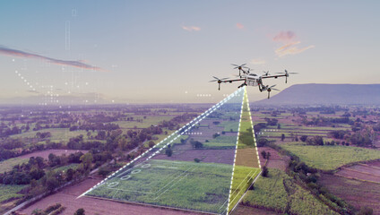
~Enhance Commercial Real Estate with Aerial Drone Shots ~
Gain a Competitive Edge in Commercial Real Estate: Photography with Aerial Drone Perspectives and High-Resolution Images.
Aerial Drone Photography: Cost-Effective and Time-Saving Solution for Comprehensive Commercial Property Shots.
Capture Unique Detailed : Aerial Views of Commercial Properties Using Advanced Drone Technology.
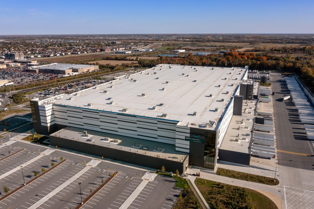
Enhance : Your Commercial Real Estate Listings with High-Quality Aerial Shots for Potential Investors and Tenants.
Save Time and Effort: Drones Provide Efficient Imaging of Large Commercial Properties.
Flexibility in Photography: Drones Access Hard-to-Reach Areas, Delivering Unparalleled Views.
Showcasing Your Commercial Property from Above: The Power of Aerial Drone Photography.
Clear and Detailed Property Insights: High-Resolution Aerial Images for Informed Decision Making.
Architectural Structure Visualization: Aerial Drone Shots Highlighting Location and Connectivity.
Elevate : Your Commercial Property’s Potential with Aerial Photography for Development Planning.
Give your clients, investors or potential tenants the advantage of aerial views of the architectural structure location to roadways or highways for your commercial property. Aerial photography gives footage identify your property and how it can be planned for development.
~ Elevate Residential Real Estate with Aerial Drone Imaging ~
Capture the Perfect Shot: Residential Real Estate Photography with A Bird’s Eye View from Drones.
Elevate Your Listings: Drones Offer Aerial Footage for a Unique Perspective on Properties.
Expansive Coverage: Drones Capture Vast Properties and Hard-to-Reach Areas Unattainable with Traditional Photography.
Time and Money Savings: Cost-effectiveness of Drone Imaging Compared to Conventional Methods.
Unleash Visual Appeal: Drones Create Stunning and Engaging Marketing Material for Residential Properties.
Stand Out in the Market: Aerial Drone Photography Sets Your Properties Apart from the Competition.
Putting Safety First: Drones Capture High-up and Difficult-to-Reach Areas, Keeping Real Estate Professionals Safe.
A New Era in Real Estate Photography: Embrace the Power of Drone Imaging for Enhanced Listings.
All-encompassing Views: Drones Provide Complete Property Overviews with Aerial Photography.
Emphasize Quality and Efficiency: Residential Real Estate Photography Transformed by Drone Technology.
Showcase your property increase the opportunity to sell your property fast with interior Virtual walk-through video. Exterior photography highlights the features and amenities while Aerial photography helps boost viewings and sales making your listing standout from the other competing properties.

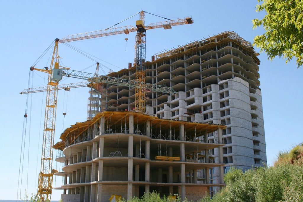
~ Construction Site Monitoring with Drone Photography ~
Elevate Construction Site Safety and Productivity: With Drone-based Project Photography and Monitoring Solutions.
Real-time Imaging for Construction Sites: Drones Enhance Safety and Efficiency without Risking Workers.
Rapid Construction Site Coverage: Drones Provide High-resolution Images and Videos for Real-time Updates.
Cost-effective Construction Site Monitoring: Drones Outperform Traditional Scaffolding and Crane Methods.
Make Informed Decisions with Detailed Aerial Views: Drones Support Architects, Engineers, and Project Managers.
Construction Documentation Made Easy: Drone-captured Media for Comprehensive Project Records.
Streamlined Construction Site Management: Drones Deliver Faster, Safer, and More Efficient Monitoring.
High-resolution Project Photography: Drones Unleash the Full Potential of Detailed Construction Visuals.
Unparalleled Efficiency in Construction Progress Tracking: Drones Capture Ongoing Site Developments.
Optimize Construction Operations with Drones: Enhancing Safety and Speed in Project Photography.
Having an invaluable tool to monitor a construction site tracking and documenting the progress of the project to ensure the project is staying within the timeline and budget. Whether the project is industrial, commercial or residential project having aerial photography can help ensure that all stakeholders are informed.
~ Streamlining Insurance Claims with Drone Technology ~
Expedite Insurance Claims with Drone Technology: Swift Assessments and Faster Claims Processing.
Precision and Detail: Drones Enhance Accuracy in Insurance Claim Inspections.
Safety First: Drones Eliminate Physical Risk for Adjusters in Hazardous Areas.
Cost-effective Claims Handling: Drones Reduce Site Visits, Travel Expenses, and Manpower.
Elevate Customer Satisfaction: Drones Deliver Prompt Assessments and Resolution for Policyholders.
Empowering Insurance Claims with Advanced Drone Technology: A New Era in Assessments.
High-resolution Insights: Drones Provide Comprehensive Views for Accurate Insurance Claims.
Redefining Claims Efficiency: Drones Speed Up the Insurance Claims Lifecycle.
Embrace Innovation: Utilizing Drones to Optimize Insurance Claim Processing.
A Seamless Claims Experience: Enhancing Customer Satisfaction with Drone-assisted Assessments.
Need to file an insurance claim use the power of aerial photography to exhibit the damage done to your home, land, equipment, out buildings or storage. Using drone photography can get those hard-to-reach area photo’s or show a wide area view of larger damage.

~ Market and Media Productions with Dynamic Drone Content ~
Unlocking Creativity in Market and Media Productions: With Drones Provide Cost-effective Aerial Shots and Unique Perspectives.
Versatile Tools for Capturing Dynamic Content: Drones Offer Stunning Aerial Images and Maneuverability in tight Spaces.
Speed and Efficiency in Media Production: Drones Access Hard-to-Reach Areas for Breathtaking Footage.
Elevated Market Promotions: Drones Showcase Project Features with Striking Aerial Views.
Captivating Audiences with Aerial Video: Drones Capture Fast-paced Events from Unique Angles.
Enhancing Safety in Media Production: Drones Replace Risky Human Pilots in Hazardous Locations.
Embrace New Perspectives: Drones Revolutionize Market and Media Productions.
Unleashing the Potential of Aerial Content: Drones Offer Efficient Access to Exclusive Locations.
Aerial Imagery for Marketing Magic: Drones Create Exceptional Visuals of Tourist Attractions and Special Events.
Overall, drones can bring new perspectives and creativity to market and media productions while being efficient. They can create exceptional marketing materials showcasing features of projects with aerial images, offering customers a unique view that only a drone can capture of special events, tourist attractions, vacation property, rental property, and Airbnb.
~ Services Coming Soon ~
Unleashing the Potential of Photogrammetry, Videogrammetry, Aerial Mapping, and Infrared Thermal Imaging Services
Cutting-edge Environmental Data Collection Services Coming Soon: Experience the Power of Photogrammetry, Videogrammetry, Aerial Mapping, and Infrared Thermal Imaging.
Revolutionary Photogrammetry Services: Transforming Photos into Precise 3D Models for Engineering, Architecture, Film, and More.
Videogrammetry: Elevating Environmental Data Collection with Motion Capture and Comprehensive Scene Representations.
Aerial Mapping Services: Gain a Holistic View of the Environment through Video-based Data Collection and 3D Modeling.
Infrared Thermal Imaging: Unlocking Valuable Insights with High-resolution Surface Temperature Analysis.
Non-invasive Environmental Data Collection: Drones Equipped with Infrared Thermal Cameras Ensure Minimal Disturbance.
Cost-effective and Efficient: How Infrared Thermal Imaging Reduces Human Labor and Resource Needs.
A Safer Approach to Data Collection: Drones Enhance Safety in Hazardous Environments through Infrared Thermal Imaging.
Advancing Environmental Insights: Prepare for Our Photogrammetry, Videogrammetry, Aerial Mapping, and Infrared Thermal Imaging Services.
Embrace the Future of Environmental Data: Stay Tuned for Our Comprehensive Suite of Advanced Imaging Solutions.
~ Conclusion ~
In conclusion, photogrammetry, videogrammetry, aerial mapping, and infrared thermal imaging are valuable instruments for collecting environmental data. Each technology provides unique insights and information that can aid in better comprehending and improving the environment. Regardless of the industry, such as construction, environmental monitoring, or urban planning, these technologies help in acquiring the data required for making informed decisions